 Former Dent Stationmaster's House and a Weather Warning  Dentdale 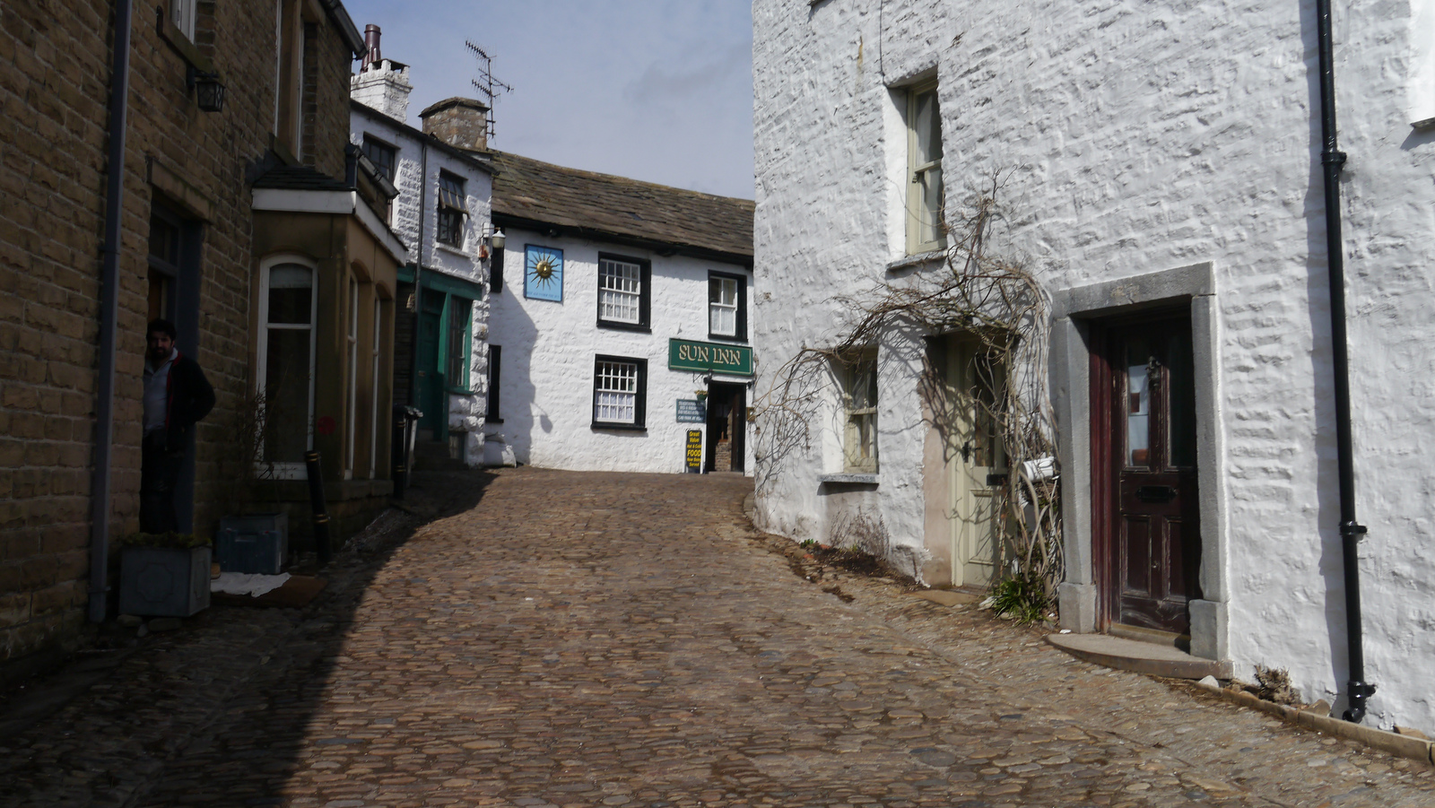 Dent 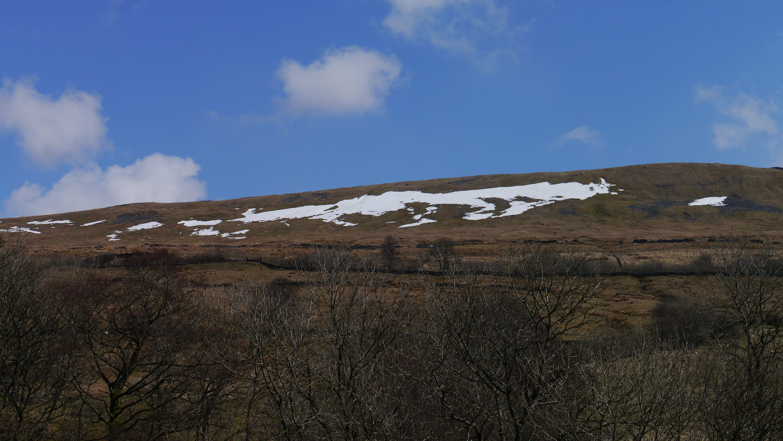 Dent Fell, Great Knoutberry Hill 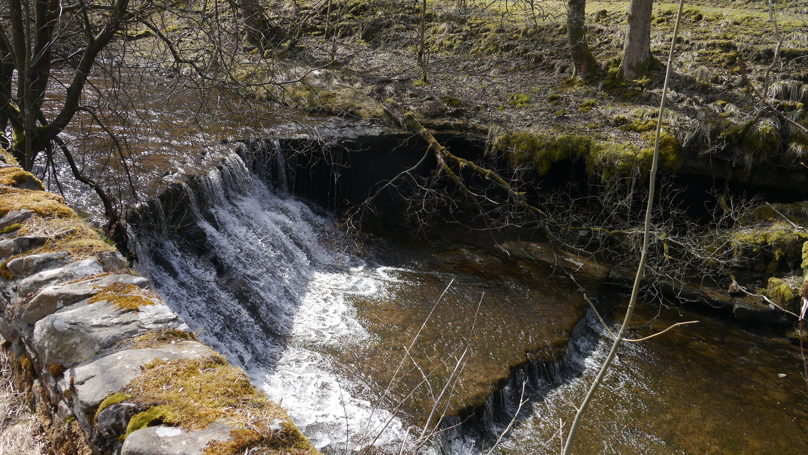 Waterfall on River Dee, Dentdale 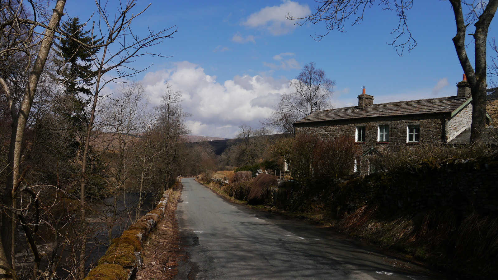 Dentdale 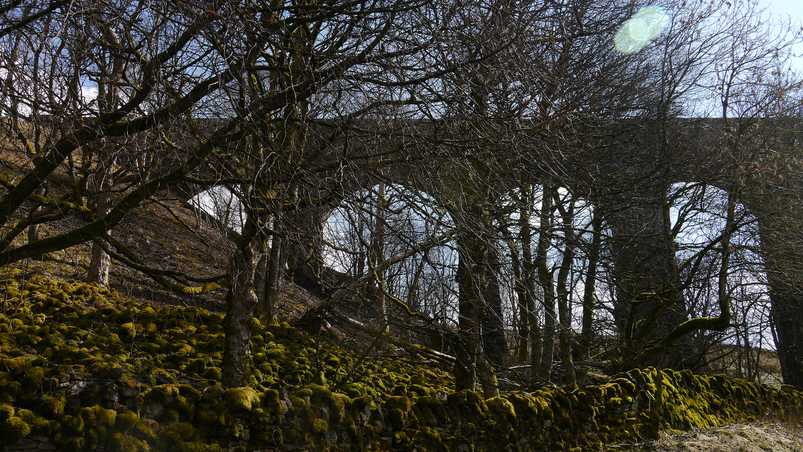 Dent Head Viaduct 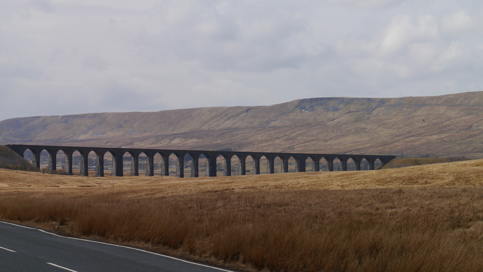 Whernside towers above Ribblehead Viaduct 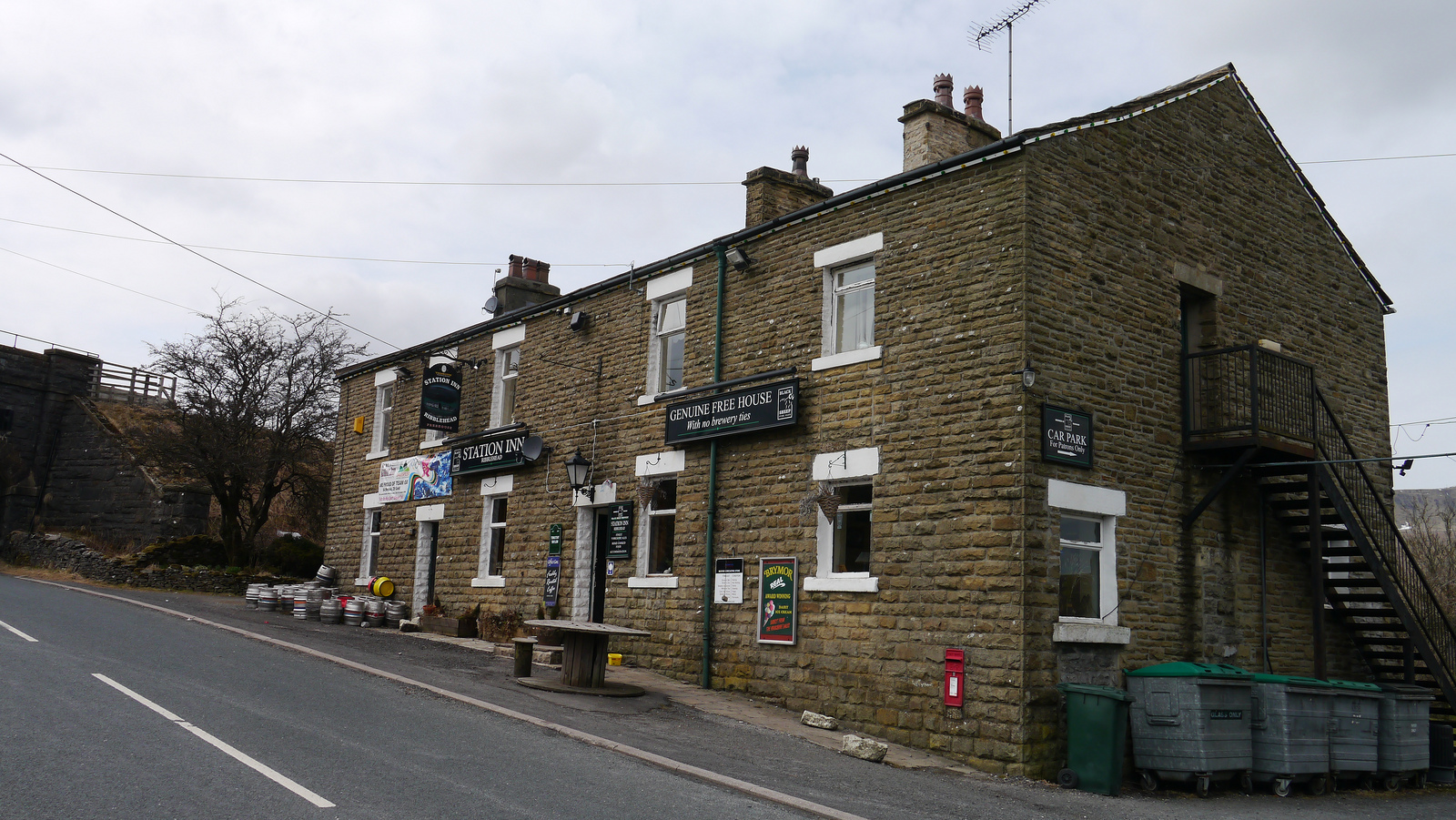 Station Inn, Ribblehead 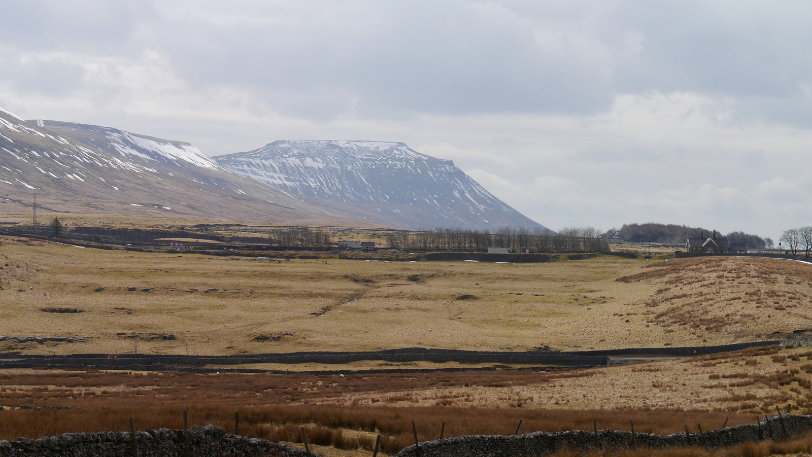 Ingleborough 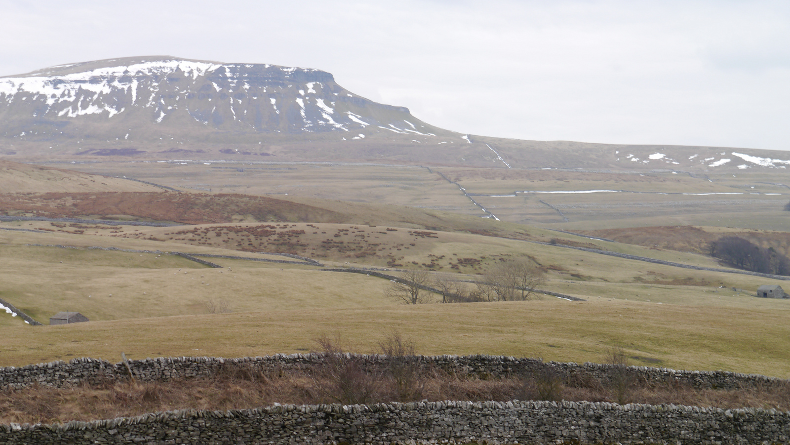 Pen-y-Ghent 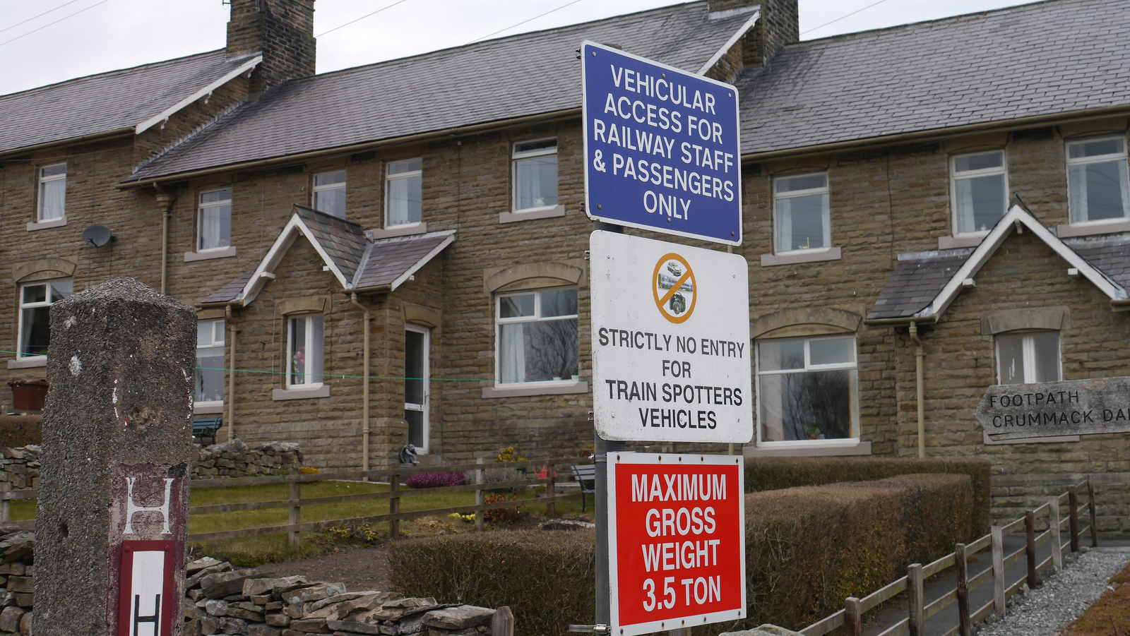 Horton-in-Ribblesdale |  A cycling blog with (virtually) no whisky! Could spring have arrived? Looked like it had this morning - and Northern Rail had kindly provided me with a weekend of free travel. I've often tried to ride as close to a train route I've taken before - not necessarily all in one go, and mostly in Scotland up to now - Glasgow to Edinburgh; Perth to Lairg; Keith to Inverness - in fact most of the main routes with a few gaps. Had done Leeds to Settle, but not beyond Settle before today. So train to Dent (DNT), highest station in England - but it's not a case of downhill all the way. The road past Dent Station goes up and over Garsdale Common to Garsdale station or down into Dentdale - which means a big climb up and over Blea Moor to Ribblehead (RHD). Dent to Ribblehead was probably the most challenging part of building the Settle to Carlisle line - a camp was built on Blea Moor for the navvies building the tunnel under the Moor, and Ribblehead and two smaller viaducts. 3 coach train from Leeds (LDS) - very busy by Skipton (SKI) Plenty of walkers getting off at Dent, who seem to regard the road down the hill as a wide footpath to spread across - must get that bell working! The village of Dent is nearly five miles from its station, and 200m below it and there are roads each side of the River Dee from Cowgill (which would be a more logical name for the station) to Dent. The station, as with many others along the line was closed in the 1970, and the station buildings sold off - Dent station is now self-catering accommodation. Following its re-opening in 1986 a stone shelter in keeping with the original architecture has been built on Platform 1. Dent also has no footbridge - which makes it easier to get the bike across the Barrow Crossing (though the National Rail site unhelpfully says "This station has Barrow or Level crossing. We do not recommend that you use it without assistance." All very well, but as this is an unstaffed station, you'd presumably wait there all day!) Dentdale is part of the Yorkshire Dales National Park, although it is now in Cumbria, older road signs indicate it used to be in the West Riding of Yorkshire, thought this part of Cumbria now borders North Yorkshire, and we left modern day West Yorkshire way back before Skipton - clear? The decent from Dent station is steep and twisty, so demands caution even without the added hazard of walkers who seem to have little regard for anyone else. At the bottom of the hill is the village of Cowgill, which is apparently a haunt of red squirrels, though I didn't see any myself. Before my hill climb, I decided to visit Dent village - a pleasant 4 mile ride between sheep filled fields, dominated at first by the snow topped peak of Whernside, then climbing a little above the river before the descent to cross it before entering the village. Dent village features a central section of cobbles and many whitewashed houses, a couple of pubs, the George and Dragon and the Sun Inn, serving beer brewed at the local Dent Brewery (it's location, Hollins, isn't marked on the OS Landranger map, but can be seen on the larger OS map via Bing), but I was there too early to visit them. Back to Cowgill along the other side of the valley - more sheep-filled fields, with some spilling over onto the road, then suddenly a horse, and alpacas sharing a field with sheep. Wasn't sure if they were llamas or alpacas, but having checked Wikipedia for both, I'm going with alpacas, but I could be wrong! Back through Cowgill and now taking the road along the valley parallel with the railway - 120m above to start with. The road runs right next to the river, whose bed features great slabs of limestone(?). The Sportsman's Inn, which describes itself as "A family owned chain of one since 1988" lies on the west bank of the river shortly before the road crosses to the east bank below Arten Gill viaduct, half the length though slightly higher than Ribblehead. The road now starts to climb towards the railway - more steeply before it comes alongside Dent Head viaduct, shorter both in length and height than Arten Gill, but still an impressive structure, with an ancient packhorse bridge behind it. Two further chevrons on the map each side of the bridge under the railway indicate the rate at which the road now climbs, but it has plenty of flat spots to rest, or take photos. The top of the road is soon reached at around 420m and it crosses back into North Yorkshire for the slight descent to the B6255 Newby Head Pass road with splendid views across to Ingleborough, more snow remaining on it than its neighbouring peaks, and Pen-y-Ghent. I took longer than I'd expected for Ribblehead viaduct to come into sight as the road accompanies Gayle Beck (the main head water for the River Ribble) down from the moor. Ribblehead is the starting point for walks and climbs in many directions, so the area around the junction of the B6479 to Settle resembles a car park. A path to the viaduct leads from there, so I head off to do my photo shoot. Back to the road via another path which leads to the Station Inn, a brief visit to the station coincides with the arrival of a train, but I'm not yet ready to head back south. After the initial closure in 1970, Ribblehead Station fell into disrepair, and the Carlisle platform was removed to make way for a quarry siding. When it re-opened in 1986, only trains to Leeds could call the, but a second platform was built in 1993 to rectify this anomaly - it is to the south of the original as the siding is still used, so the station has staggered platforms connected by a barrow crossing. The station has now been restored and houses a museum and tea room run by The Settle and Carlisle Railway Trust. one of three organisations making up the Settle-Carlisle Partnership, the others being the Friends of the Settle and Carlisle Railway and The Settle-Carlisle Railway Development Company. Together they have promoted the restoration of the line since the days when British Rail was trying to close it. The Friends were instrumental with other organisations in presenting the case against closure and keeping up the pressure on Michael Portillo, the then Transport Minister, until he announced that it would not be closed. It's back to the Station Inn for a pint to replace all the liquid I've lost on the ride so far, they also do food, and have a small, eclectic selection of malt whisky, including some single case bottlings from Robert Graham. By this time the bright skies of the morning had given way to grey threatening cloud, and once I started on the road to Settle I found that I had a considerable headwind to contend with, but there's a long gap in the timetable in mid-afternoon, so no option but to keep peddling into the wind. Horton-in-Ribblesdale has a couple of pubs that look OK, but I think I should carry on. The station does have one interesting sign at the station, specifically banning train-spotters from parking! Unfortunately there isn't a sign on the road banning moron bikers in their incessant noisy convoys. It seems that that noise is more important than speed to these nutters - what's the aim are they just trying to terrify the sheep? For some inexplicable reason it's still illegal to shoot them - even on the glorious twelfth. At Helwith Bridge there' s the opportunity of crossing the river, hopefully to a more sheltered, biker-free road. Well at least I've left the bikers behind, but still have that headwind to contend with, and by the time Settle comes into view, the threatened rain has started in earnest. Quick dash through Giggleswick (GIG), it's a small town that runs into Settle, but it has its own station on a different line - unfortunately it only has about 5 trains a day, so it's on to Settle (SET), just half an hour to the next train back to Leeds (LDS). I'm even too wet and windswept to consider a stop off at Wright Wines, Skipton's whisky shop! Live Train Times: Garsdale, Dent, Ribblehead, Horton-in-Ribblesdale, Settle, Giggleswick, Skipton, Leeds Pictures on Flickr at: http://www.flickr.com/photos/martynjenkins/sets/72157633243215777 |
|
0 Comments
|
Archives
December 2017
Categories
All
|
 RSS Feed
